Category: Hiking-Trails

Spooners Cove 25K- Race Recap

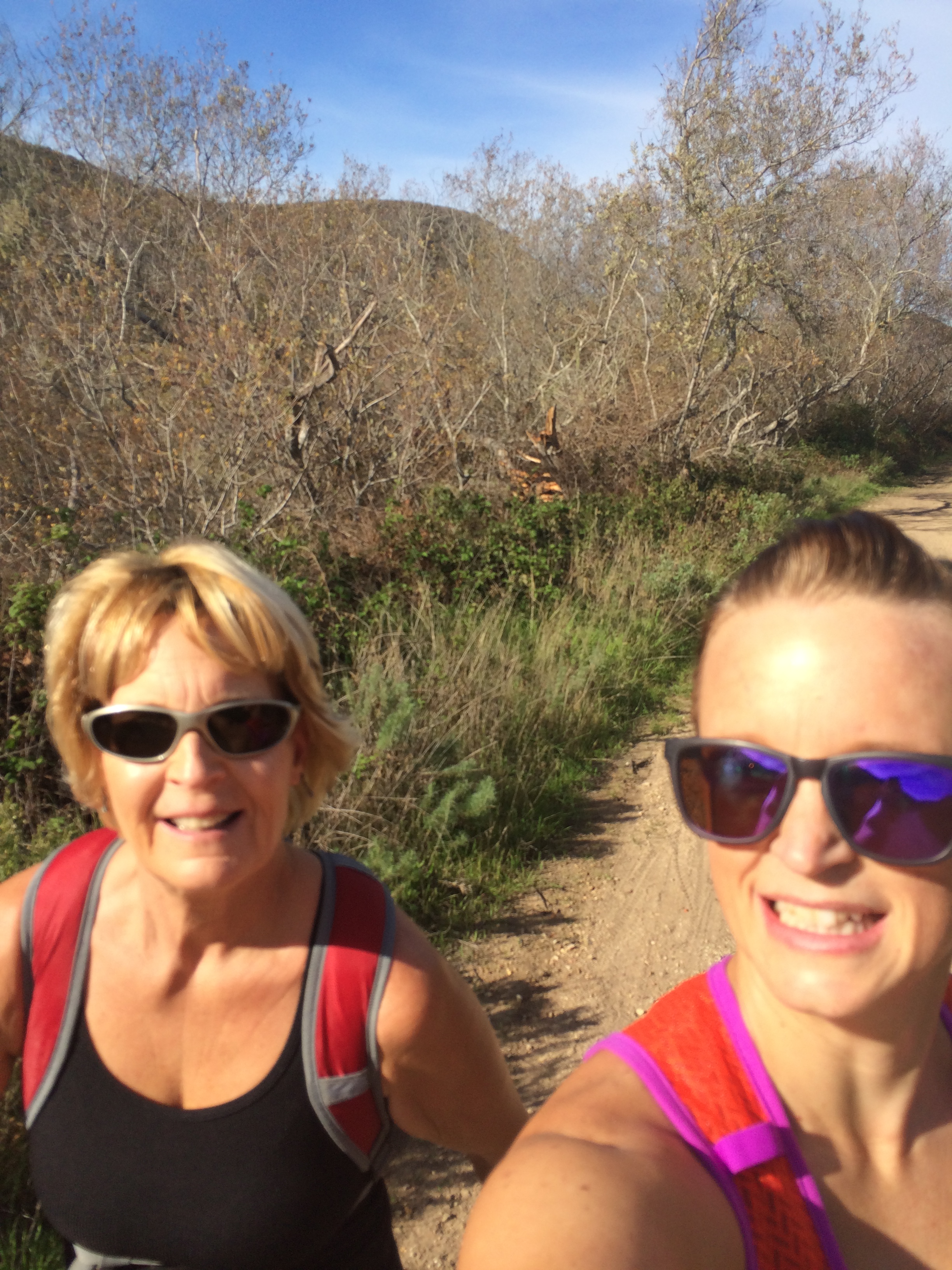
First race of the year, first 25K, first recap of the year!   And it was a doozy.  I tend to get long-winded in recaps so let’s see if I can condense this somewhat.  And feel free to shake your head and grumble/ yell while you read.

Thursday- Checked the race website late that night and discovered a course change.  They had offered a 5 mile, 7 mile, 25K and a 50k.  Now the 7 mile was an 8 mile and the 25K course had changed.  Previously the description said that the course was out the Bluff trail up and down Valencia Peak, back to start and then up to the grassy summit of Hazard Peak and back.   Now, it stated that the course was up Hazard Peak, down the backside to a farther point before turning around.  Waah.    Truthfully, I had been trying to talk my mom out of doing the 25K for the last two weeks- all the way up to start time.prerace

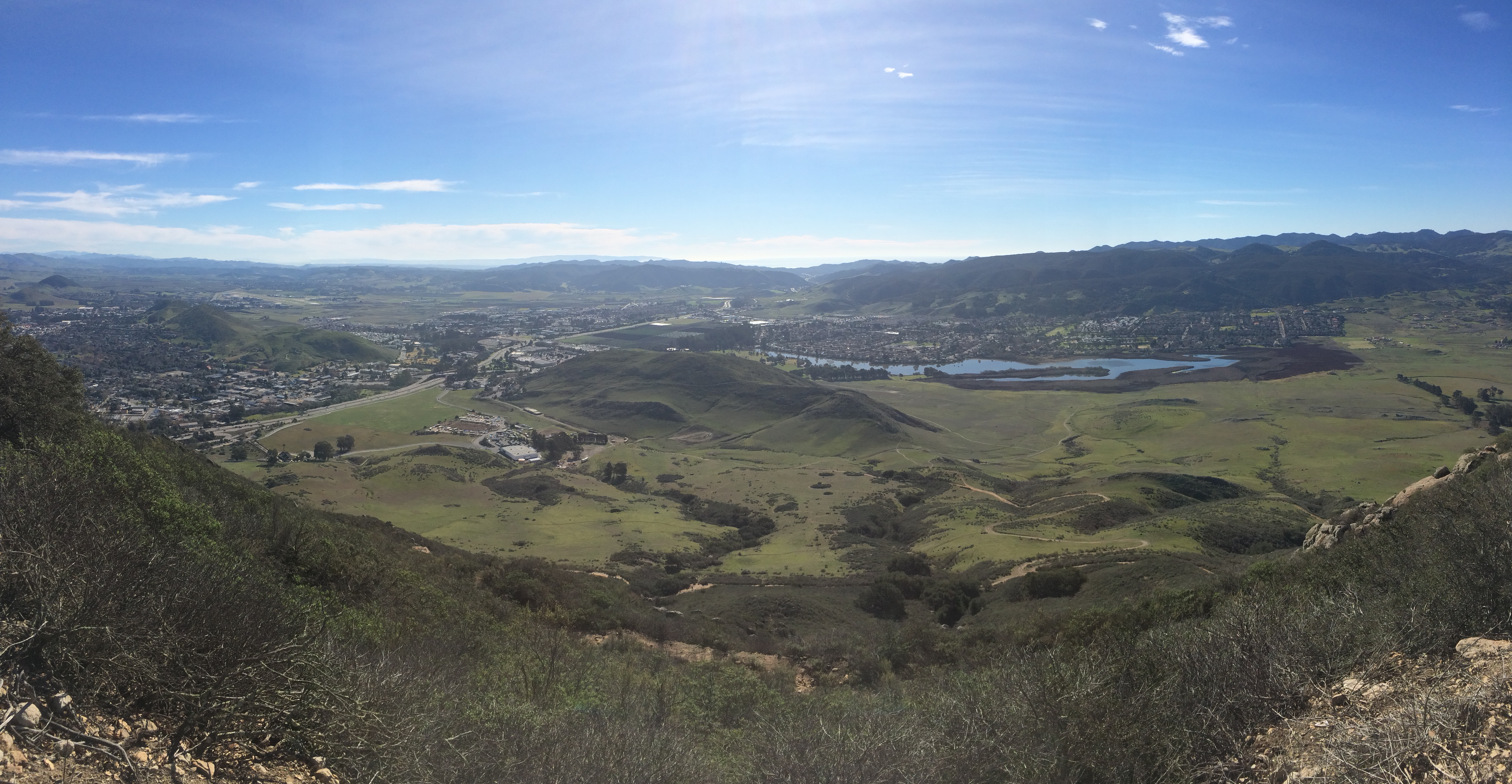
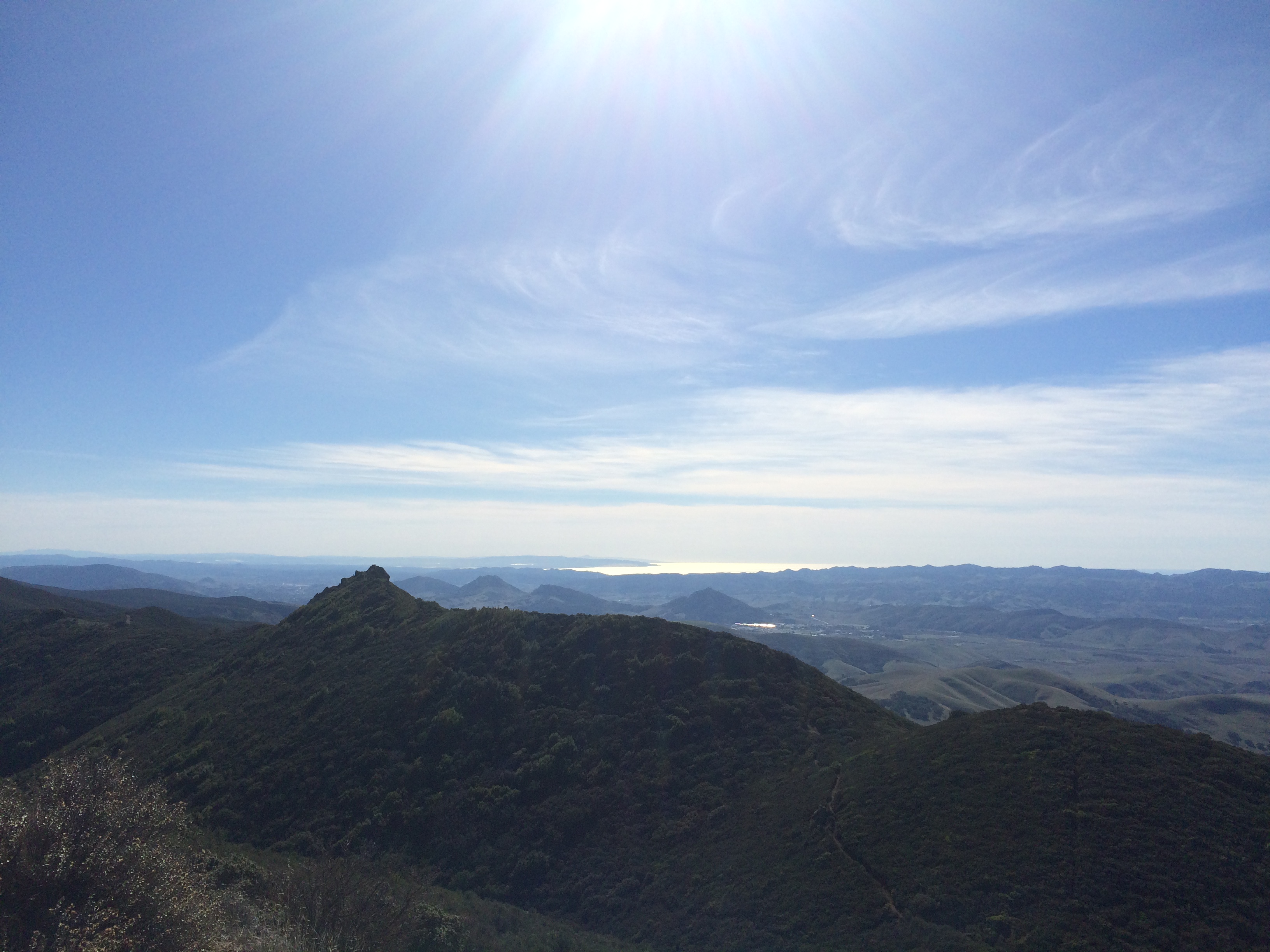
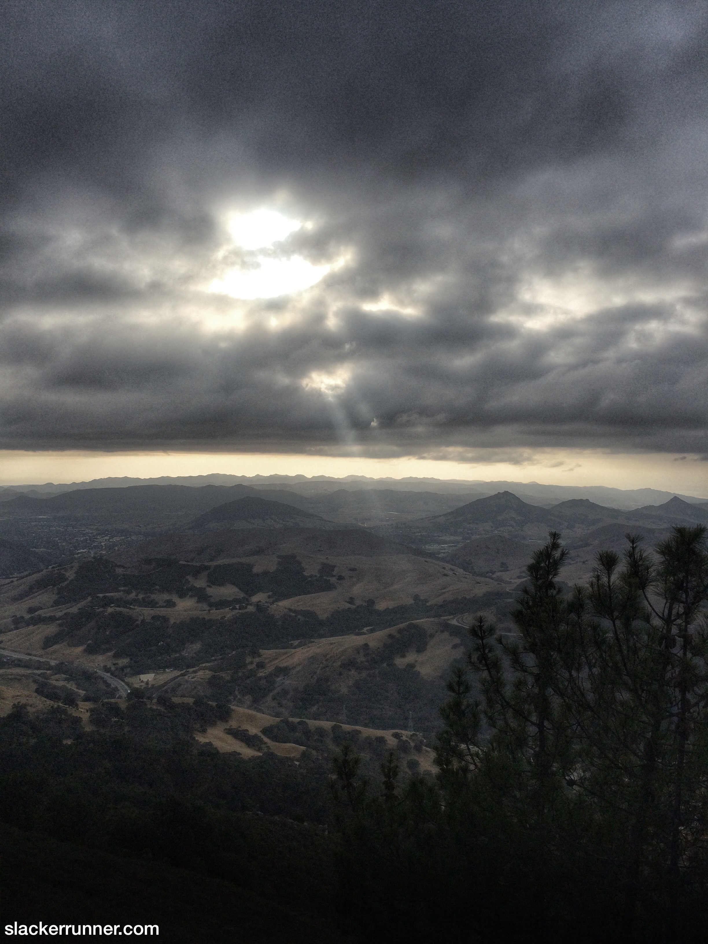
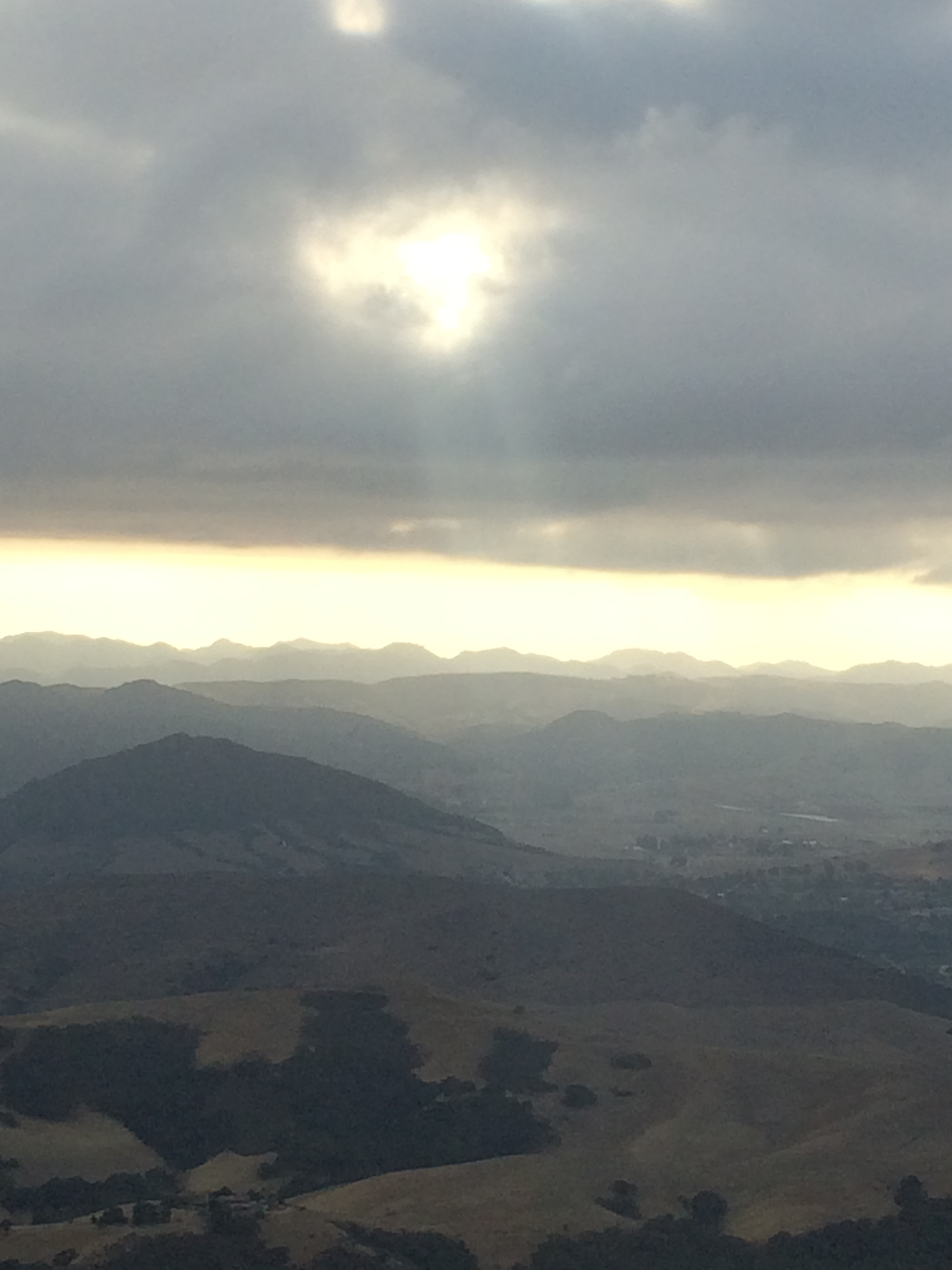
Race morning dawned bright and sunny.  It was 65º at the start with not a cloud in the sky nor fog-in January.  See where this may be going?  There were a few pre-race announcements and we were off!IMG_8810

Miles 1-3 —-14:02, 14:02, 15:52

Ok, not too bad, we’re doing good.  Damn, mom walks fast, I can’t keep pace, but when I jog I out pace her.  Tricky, tricky.  Mile 3 starts the climb.IMG_8824

Mile 4-5—- 18:34, 26:48 

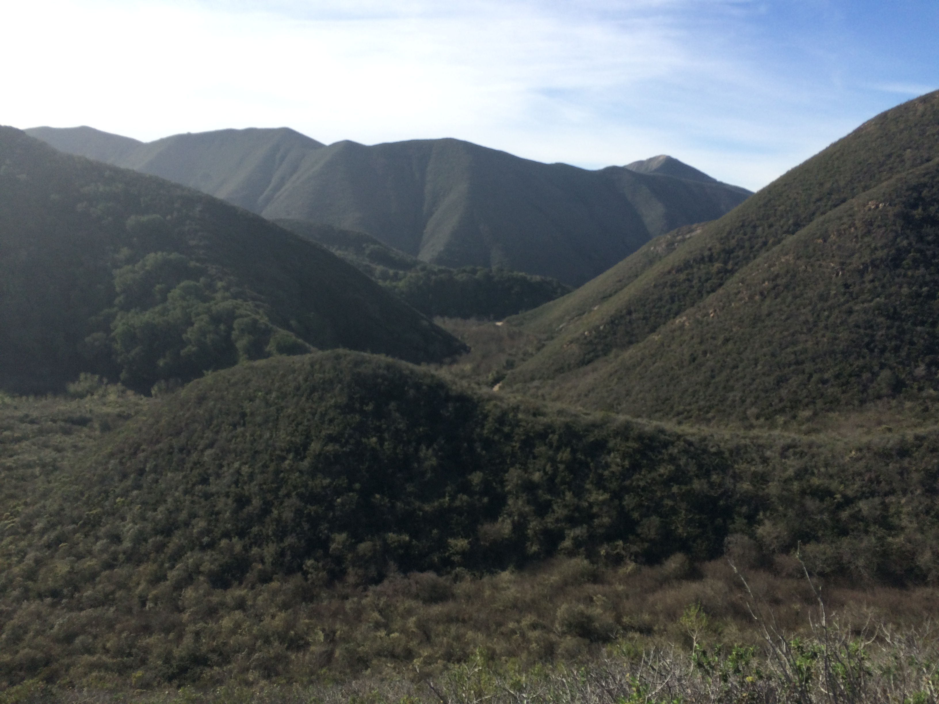
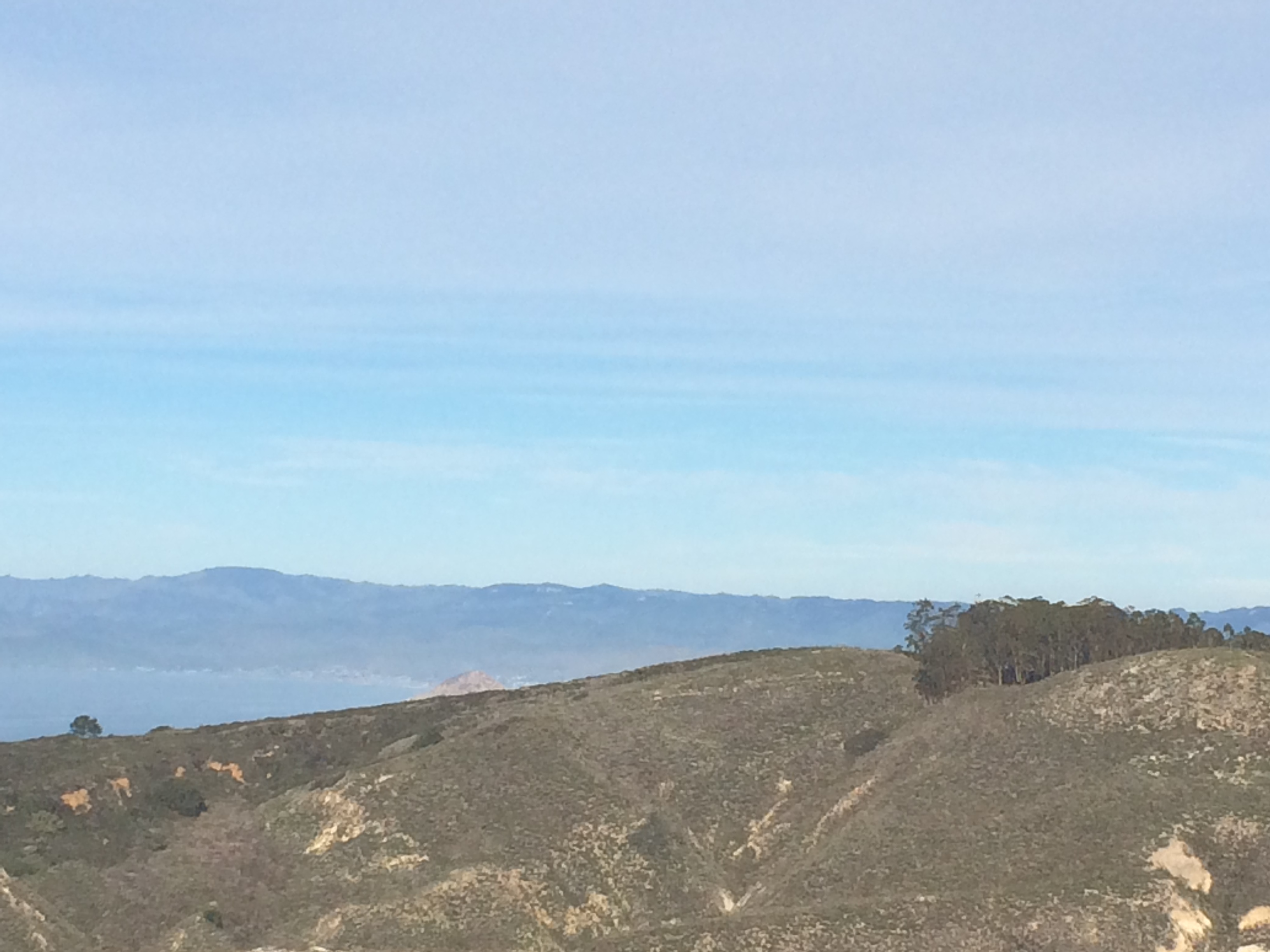
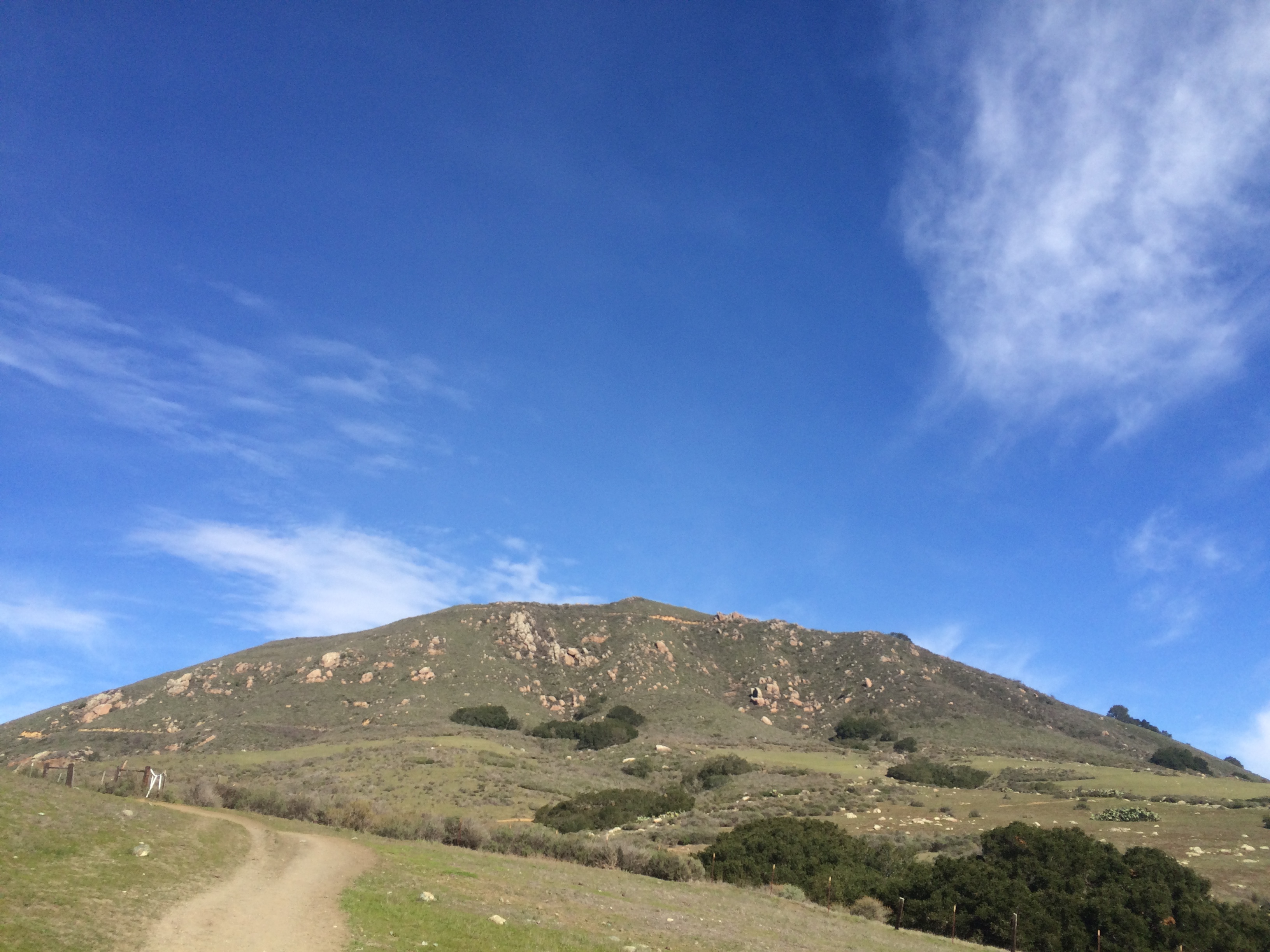
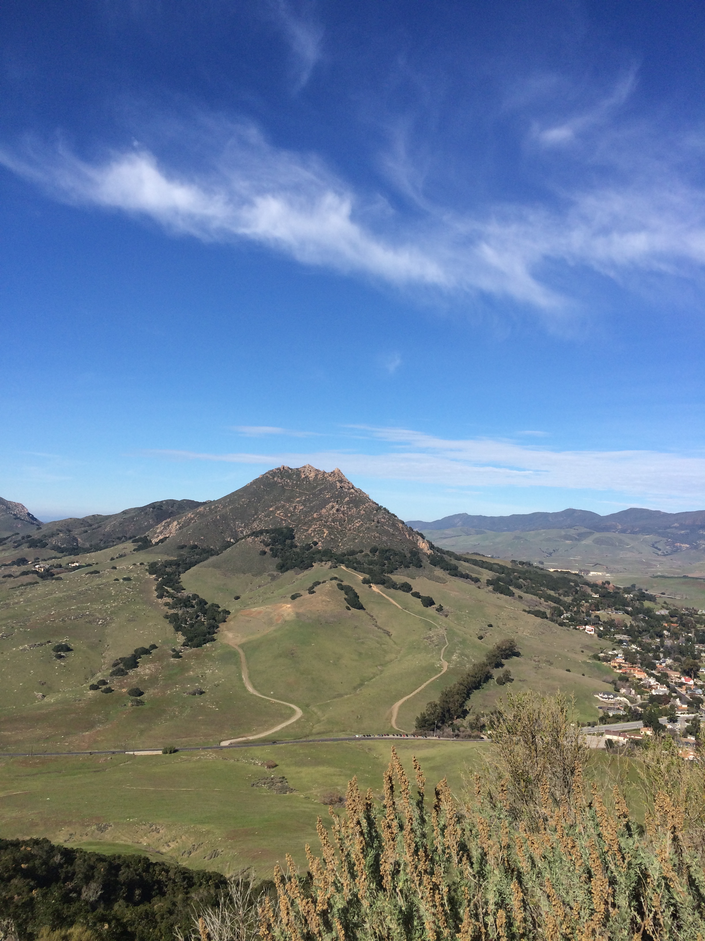
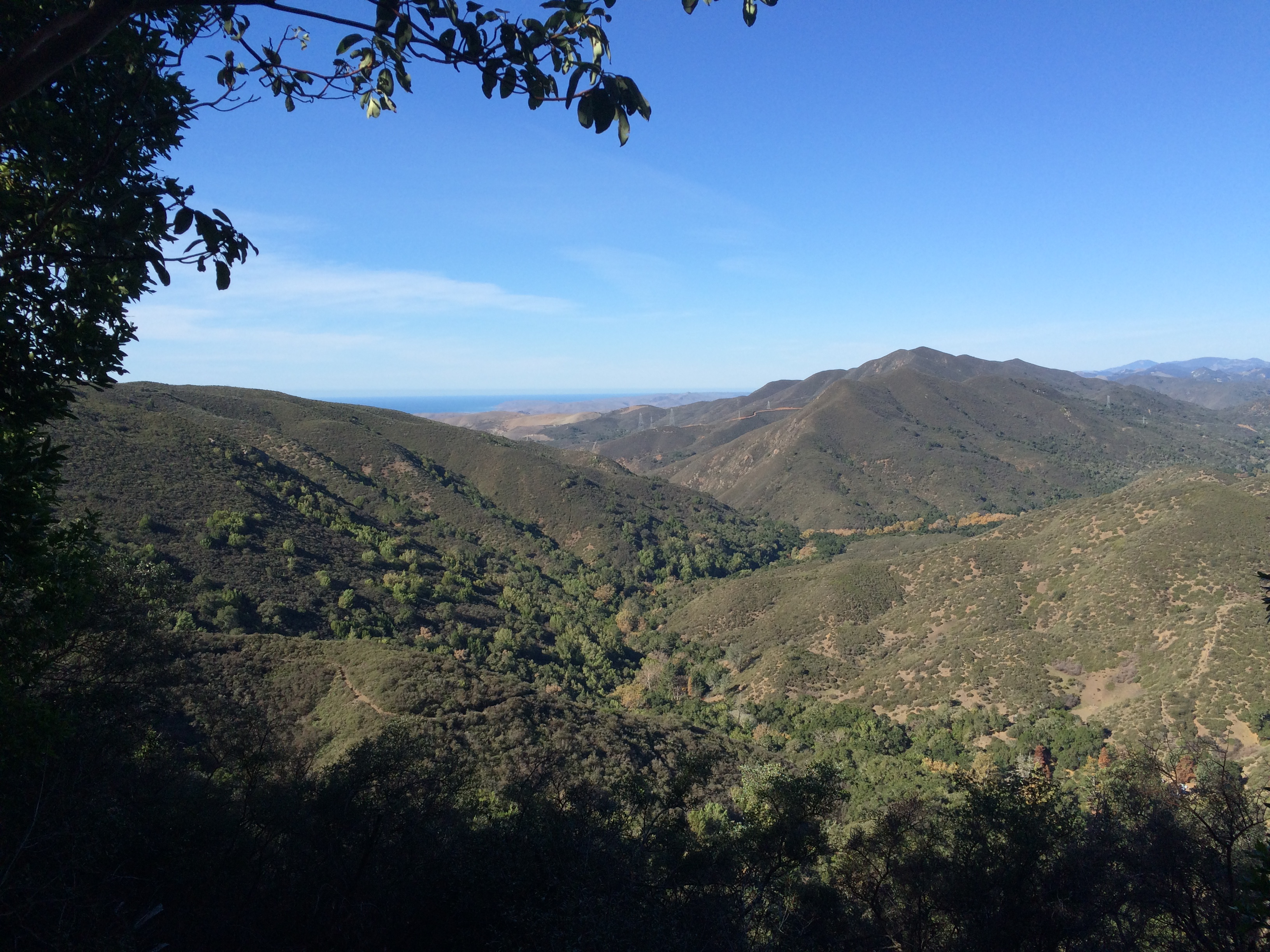
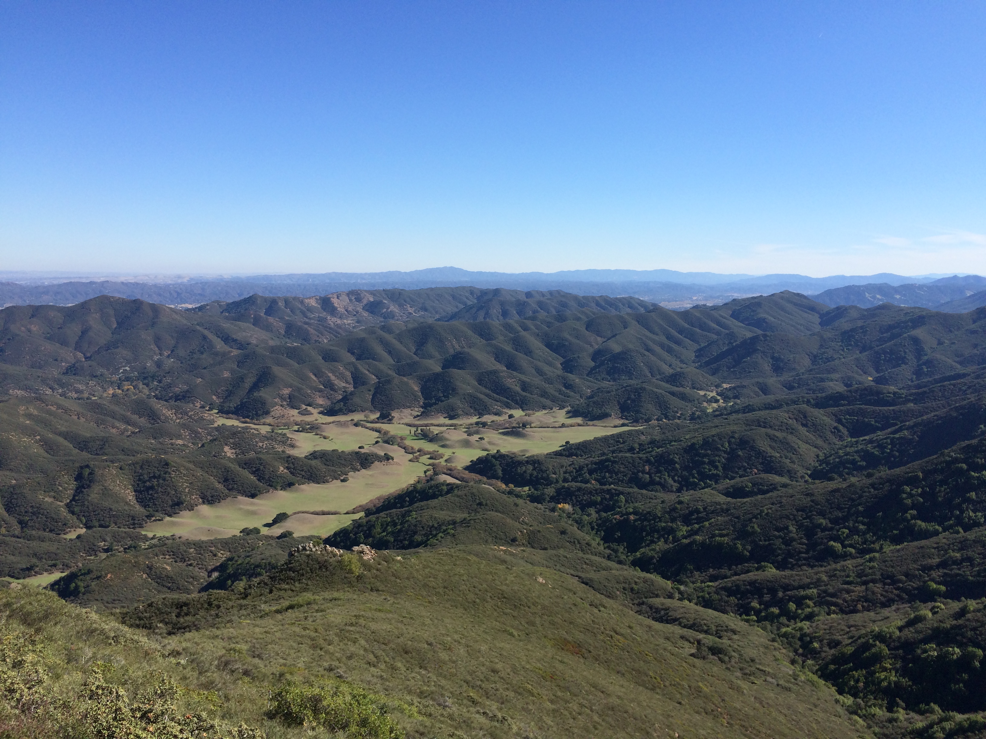
Hello Valencia.  I start outpacing my mom, her knee was sore but it was manageable.    I stopped and waited for her at times on the way up.  Disclaimer- she told me to do that- shouldn’t have done that.    The thing about Valencia is that it is deceptively tall, you think you’re near the top, but it takes so long.  Plus the shale makes footing sketchy.  But we made it- first climb done.IMG_8849

Mile 6-8 —- 22:14, 15:27, 15:38

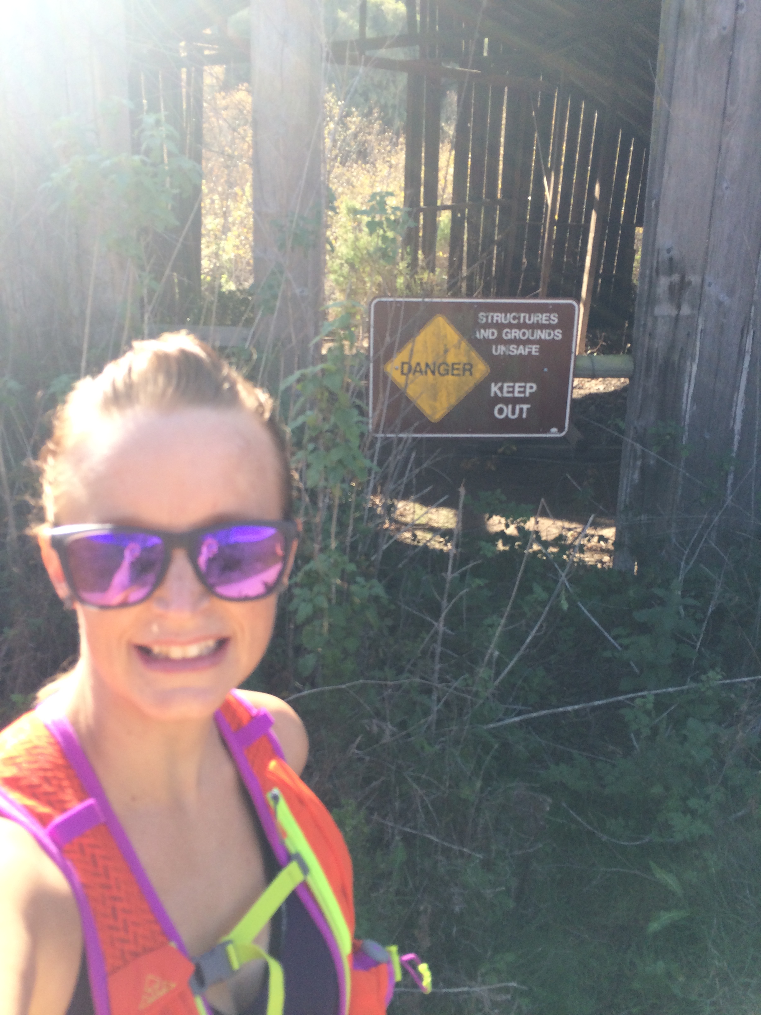
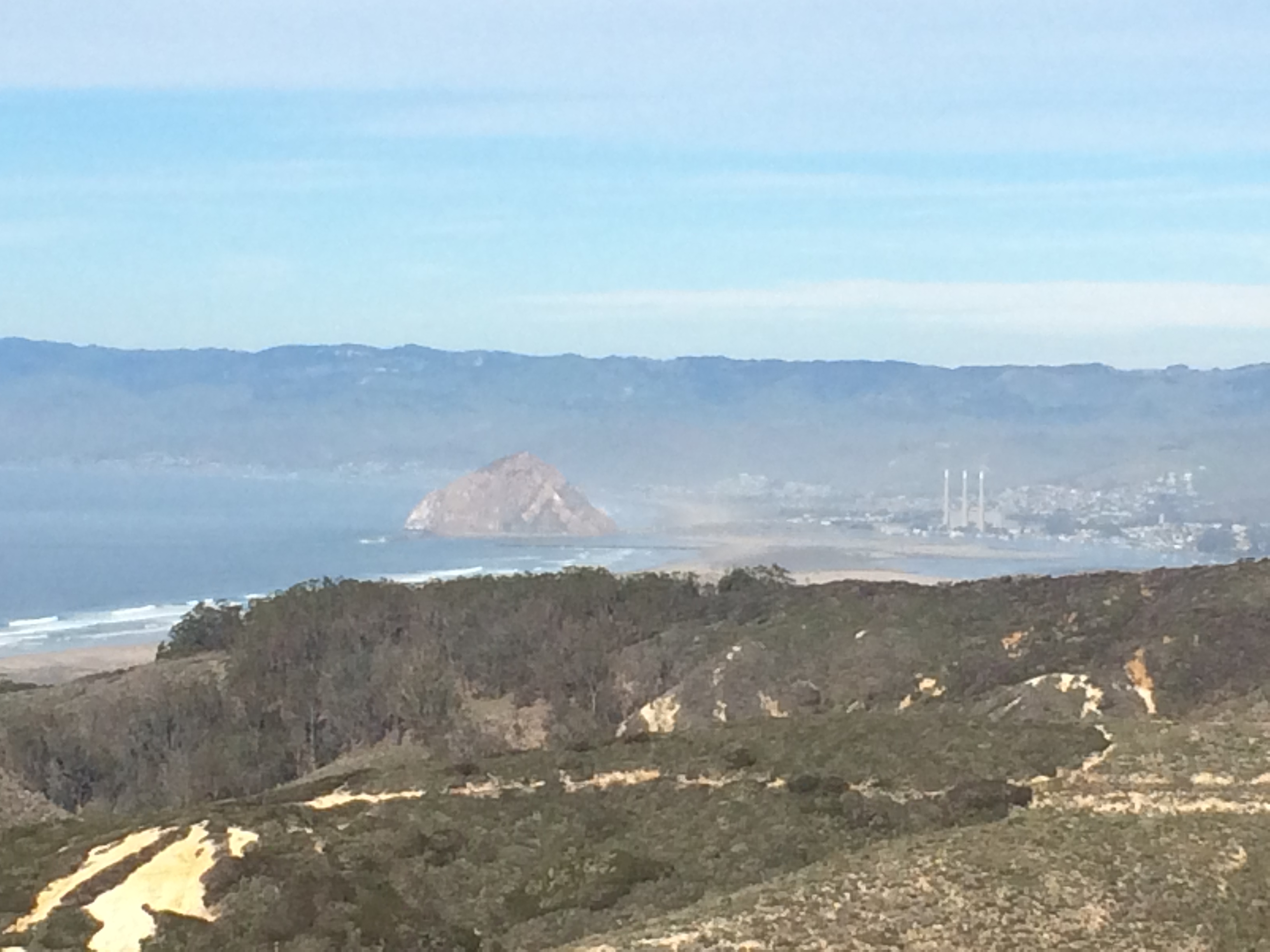
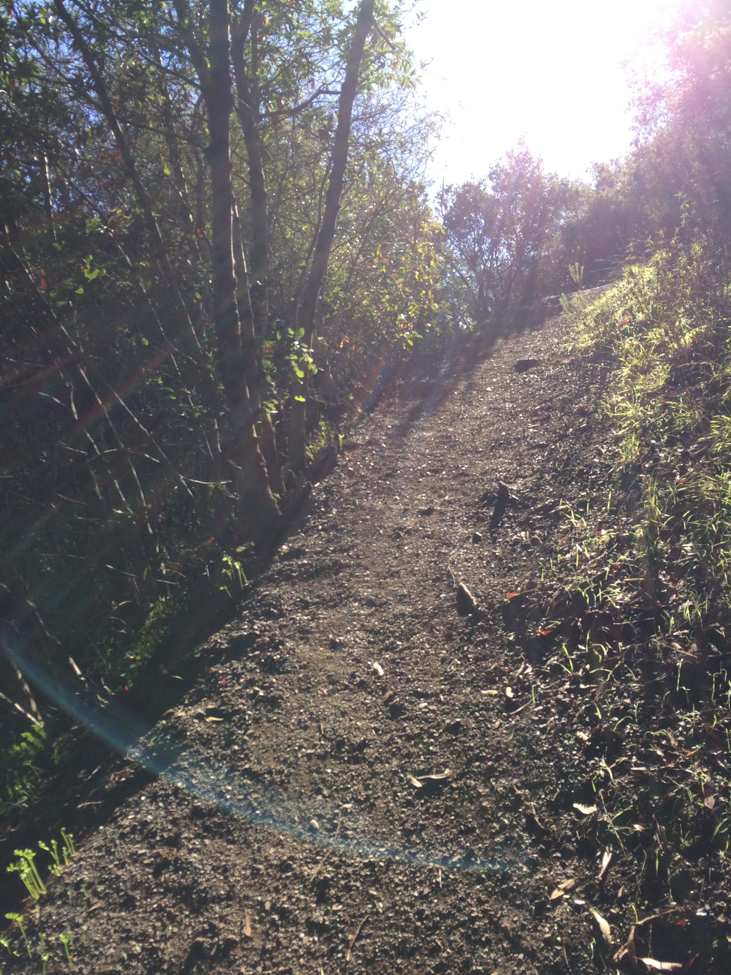
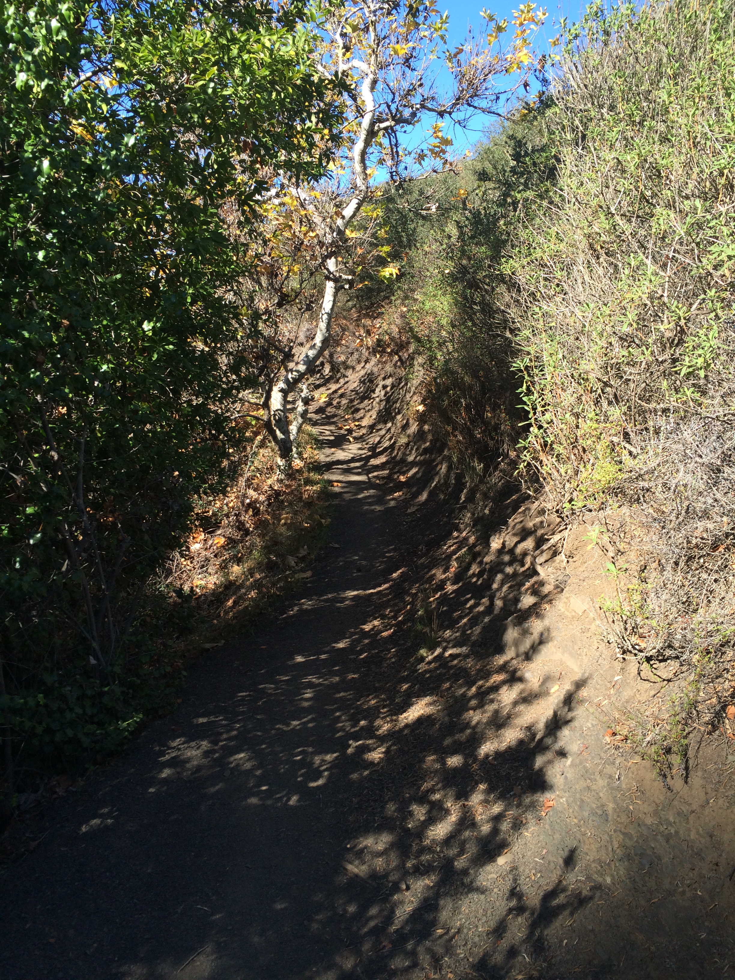
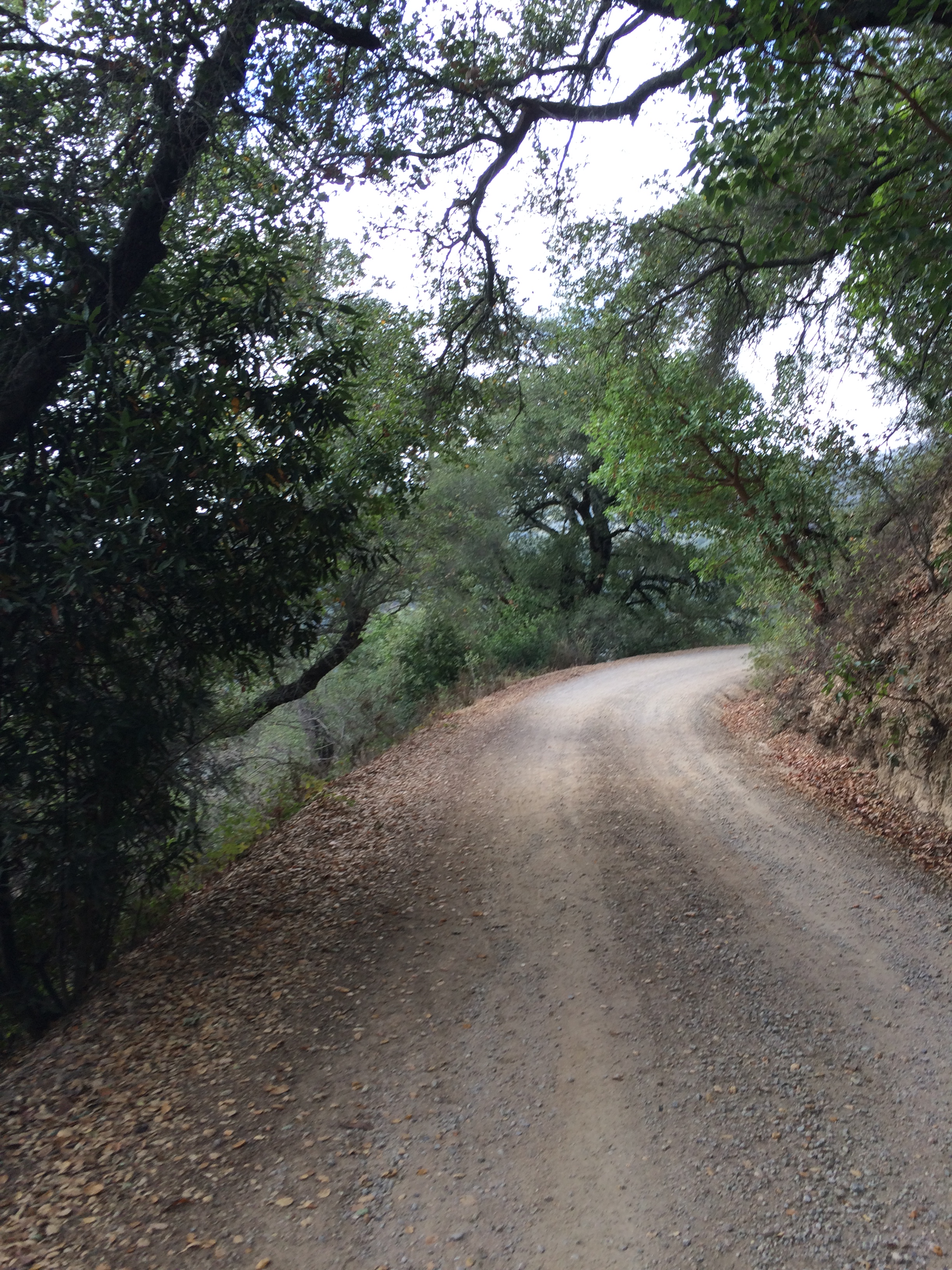
Again, shale made the first part of the downhill sketchy but we turned to a different trail down.  Hard pack, much better.   Picked up the pace as we made our way down to the start line and only aid station.  Those continuing on for the 25K and 50K went down some funky stairs behind the finish line before going through the parking lot up another set of funky stairs to another trail.  Let’s call them the stairs of death.    Man-made, uneven, random heights and absolute hell for someone with a sore knee.  Can you guess what’s coming?IMG_8842

Mile 9-11 —- 20:53, 22:41, 25:37

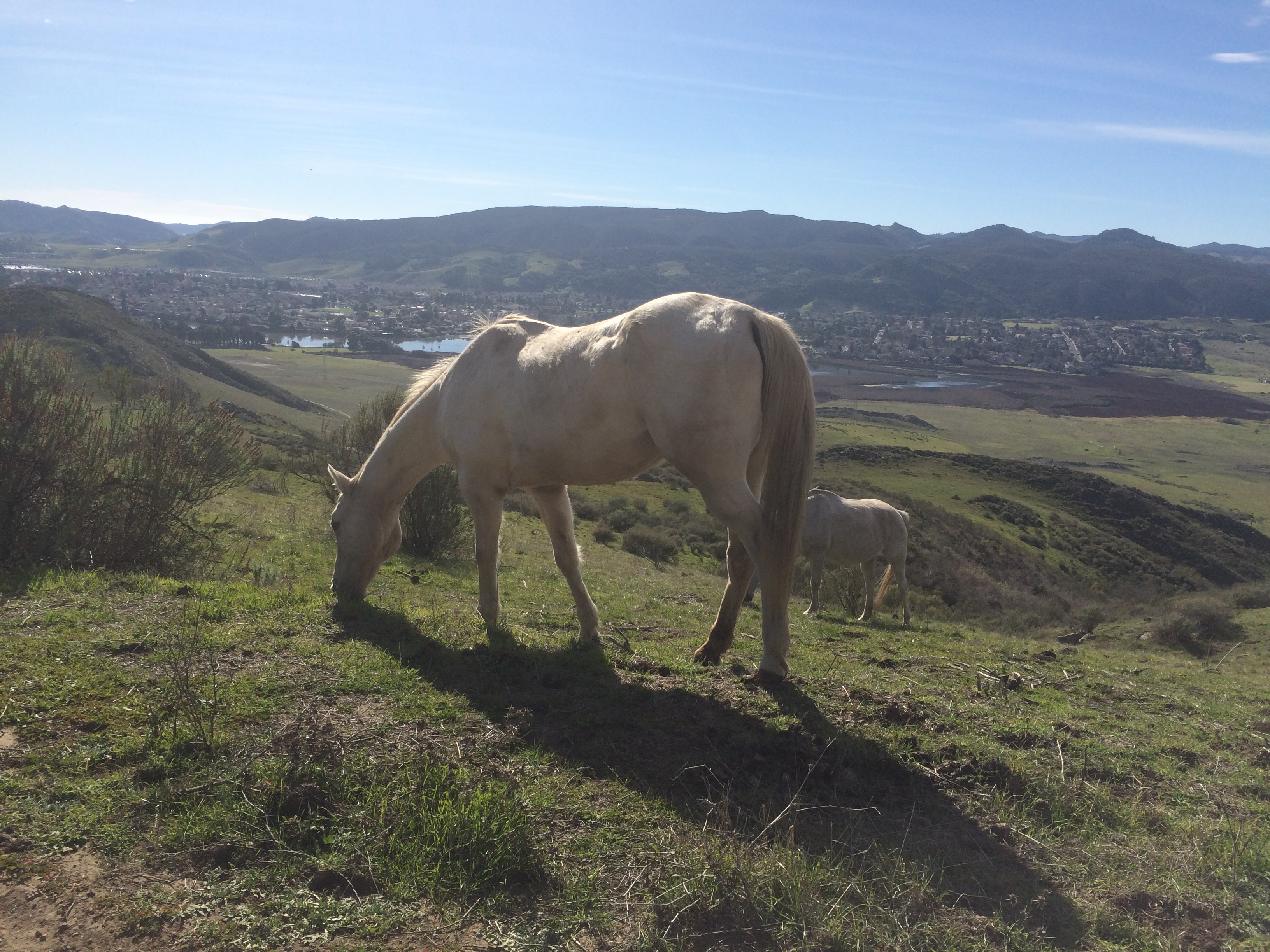
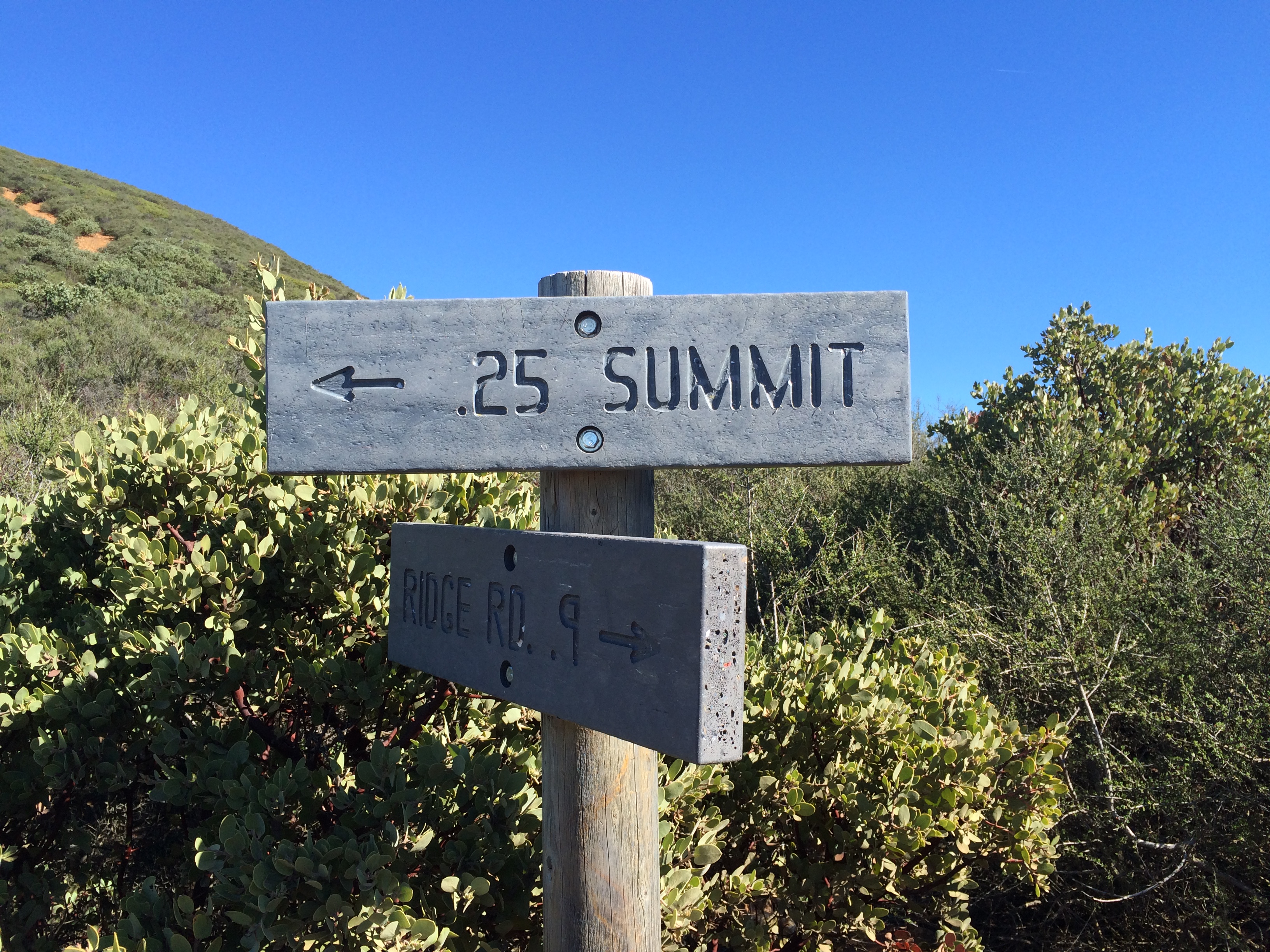
Heading up Hazard in full sun, the temp had climbed to above 70º.   My mom was in pain and slowing down.    I was trying to not get too far ahead of her but sometimes I did and would double back.    She started cramping at mile 10 but refused to quit.  She had been drinking water and had eaten her fruit snacks but it was hot out there.   We stopped and I made her drink more and gave her the pretzels that I had in my pack for the salt.  I also took her pack at this point.   We continued up pausing for all the runners coming back down and mountain bikers and horses.    Once at the top of Hazard, I tried to get her to quit again.    I also thought it was only .5 mile to the turn around. Ha!!  Closer to a mile.   A nice runner offered my mom a gel but we didn’t think it would help.  I had become a water dictator and was telling my mom to drink every 2-3 minutes.   I also noticed that my Garmin was off… by a lot.IMG_8882

Mile 12-14 —- 23:12, 23:35, 20:04

It was hot, she was cramping but refused to quit.  I ate it on the shale but managed to pull some cool shale surfing move and stayed mostly upright.  At least it felt cool, not sure what it actually looked like.    At this point a woman passed us on her way back and says-“Oh, I thought I was last”.  Umm, not cool.   Particularly when there were 2 people behind us.   On the way to the turn around, I pulled out my phone and noticed numerous texts from the Pops.  Crap.  I tried calling but lost signal.  A nice runner man had given my mother 2 salt tabs at that point.  They didn’t stop the cramps but probably kept them from getting worse.  My phone rang when I was almost back to the top of Hazard- Pops!.  My mom was a little behind me.   He asked where we were (mile 13) and I predicted it would be another hour at least.  He asked about our water- I said she still had a bottle and I had given her my Gatorade.  What I didn’t tell either of them was that I was completely out by then and we had 3+ miles to go.   I felt fine but knew it was getting warmer and that was still a fair amount of distance to go.  I popped a piece of gum so I could trick myself.    🙂  I had started the day with 3x the amount of water I usually take for a half marathon.

The hideous I'm out of water face
The hideous I’m out of water face

Miles 15-16.2 —-18:12, 17:56, 3:17

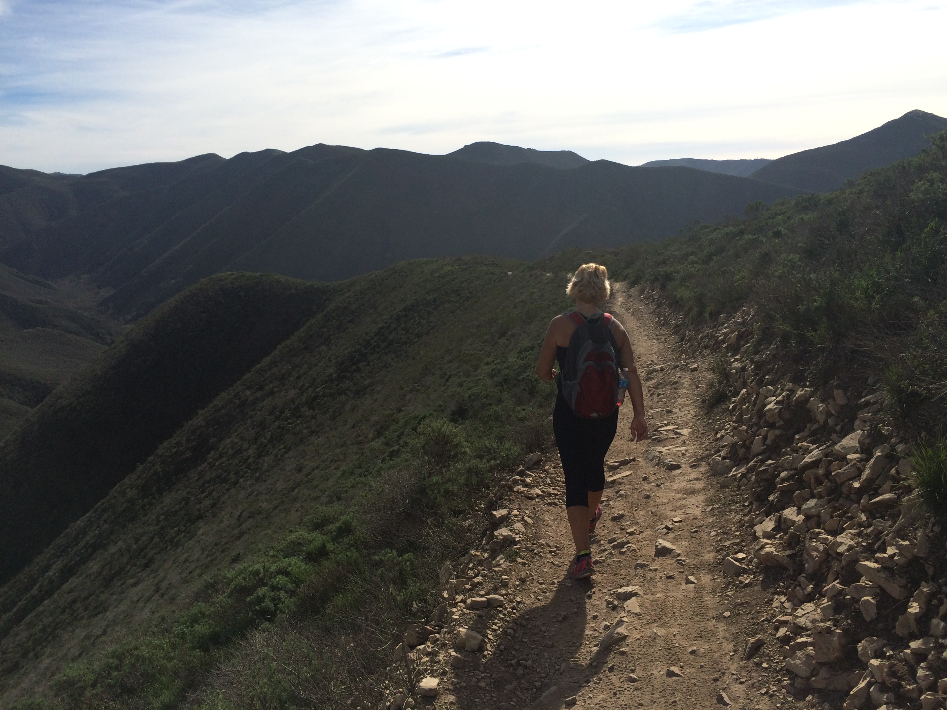
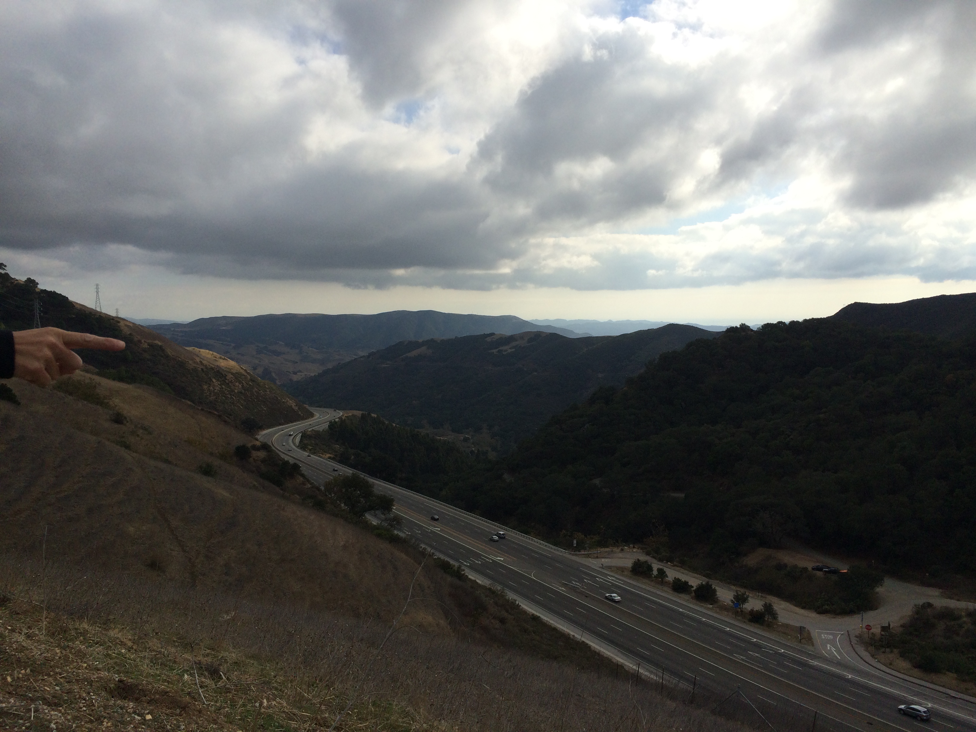
We kept plugging along.  I stilled yelled drink every few minutes and we paused when she had a cramp.  She now says she will never tell a tennis player to play through the pain again.   Just before mile 15, I looked ahead on the trail as it had widened out and saw something awesome.  Pops!!!  I literally threw my hands in the air and yelled this.   He’d come to see the finish but brought supplies because he’s awesome like that and had started hiking our way when we had talked on the phone.  He had his camelbak and 2 20oz bottles of water.   He’s the best.  I took a bottle and we trekked on.   .3 miles from the finish line, the only 25K person who was still behind us ran past.  Boo.  Once again we ended with the damn stairs before crossing the parking lot to the finish line.elevation

Finish — 5:18:10

Once crossing, a volunteer saw me first and asked if I wanted a soda or water.  I said my mom needs water, she grabbed a bottle and ran to my mom.   We made her drink that and brought her some watermelon as well.   She was glad she finished but she was hurting.     After water and some stretching I realized that we should have seen Pops by now.  So I left her at a picnic table with the packs and water and went to find my pops and get the car so she didn’t have to walk back up to where we parked.   I found pops waiting in his truck, he said he’d already walked more than planned and was not going down to the cove.   We chatted for a bit and I went to move my car to go pick up my mom so we could all go to lunch.medal

I was stuck.   I tried to back up and just spun my tires.  Seriously?!   My poor car.  I was near my pop’s truck, so I opened my door and yelled for my daddy.    There was group of high school boys out hiking that day and 2 of them came over to help too.   I finally got loose and headed back to the cove.  By now my mother was walking up because she was wondering where the heck I was.  So with all the drama, we have no finish line pictures. Boo.

But we finished!  Should we have?   Probably not.    She agrees that next time she will stick to the 8 mile.   If this race had been last November like usual, I think she could have rocked it.  It wouldn’t have been so warm and she wasn’t hurt yet.

I am not sure why my Garmin was almost a mile longer.   I know I walked balk to her a few times but even she agrees it wasn’t enough to get anywhere near a mile.     I am not sure if anyone else had a similar issue as we were the last 25k finishers and didn’t do a lot of chatting after.    The race was very explicit about the fact that they only had the one aid station and that you needed to carry your own water in between but I think with the temperature being so freakishly high they should have put some water bottles up by the turn around.   Just after we left my pops on the trail, a volunteer with a full camelbak was heading up.  His plan was to be a roving water station, but by then everyone was 5 hours in.    Looking at the finishing times, one 50K’er took the full 9 hours.  It hit over 80 that day.   Which is great for a day at the beach not so much for an ultra marathon.

Giant shout outs to everyone who helped that day- the girl who offered the gel, the man who shared his salt tabs, the awesome volunteer at the end who helped my mom.   I am horrible and didn’t get names but they were all awesome!   And I met another SLO ambassador at the top of Valencia- Hi Jason!   And to my awesome pops, he saved the day,

Damn, that was still epically long.  Sorry!

No questions today, just share your thoughts!

Sunday Summit- A Little Lost

Finally.

After 11 days off (stupid flu!!!) I finally got out there and did something!  I also made it to work on Thursday and Friday.   Wowza, Thursday was rough, I was exhausted.  No lie, I got through the day with a lot of Diet Coke.  But anyways, on to Sunday.IMG_8590

With the 25k 7 days away, eek, Sunday was my last day to get in a trail run/hike.   Plus I needed to test run my race day gear.  Because of the narrowness on the trails and the chance for ticks, I am wearing clothing that is a little more form-fitting than usual.   I also had a new hydration vest I needed to test.  The first one didn’t work out so well.    It didn’t fit right with water in the bladder and just didn’t feel like it was made well.  I replaced it with a new one a few weeks back but hadn’t been able to test it yet.  This one doesn’t have a bladder but has 2 water bottles in the front.  I stashed snacks in the back pocket and filled the bottles.   Success!  Well, except I haven’t figured out how to easily access my phone.  But I’ll work on that.  🙂IMG_8603

With me being sick and my mom being slightly hurt, we have readjusted our general time goal for the 25K.  Sunday, the plan was to head out to the race course and hike part of the last out and back.  According to the course map, that section is 8.4 miles.   We had troubles finding the right trail head but we were near another one that my mom had hiked before and really wanted to again.  The sign said it was 3 miles and it looked to be all fire road.   Fine by me, 6 easy miles was probably all I was up for anyways.IMG_8621 IMG_8626

It was freakishly warm!  High 70’s and I was burning up!   Being a fire road, the trail was easy but I was still coughing a bit.   The trail ends near a worn down, beat up, old barn.  It was equal parts creepy and cool.    So of course we had to take a few pictures right?  IMG_8634When we headed back, we passed a tiny, almost hidden single track trail head.  My mother insisted she had hiked it before so we should do it too.  Holy mother of incline.   We gained 700 ft over the next 1/2 mile.    Once we finally made it to the top, we found a picnic table.  We took a break and ate a few snacks.   And enjoyed the view.  🙂   We headed back down another way, hoping it was shorter way back.  Ha!IMG_8639 IMG_8666

Since we weren’t positive what mountain we were on, I pulled up a park map on my phone.   It didn’t really help.  Or maybe I just don’t know how to read it.  Eventually we found our way down to a trail intersection.  According to the map, the right trail led to a dead-end and the left trail was the backside of Hazard peak.    We went left which meant we then had another climb in front of us.     My mom’s knee was just starting to hurt and we coming up on 6 miles and we weren’t even at the top of the mountain.   Our pace had slowed but we mad it to the top once again and enjoyed more views.  There were some mountain bikers at the top discussing trails and I overheard one say that the trail we had not chosen led to another fire road.  Really?!  That would have been so much easier!  Where were they when we could have used directions?IMG_8645 IMG_8670Then it was time to head back towards the parking lot, down the front side of Hazard Peak.  So at least we were able to check out the race course from that direction.  Down hill it’s not too bad, but I am wondering what the uphill will feel like after 8 miles.   Guess I’ll find out next weekend!  We finally made it back to the parking lot- 9.65 miles later.   We survived, haha!  IMG_8701 IMG_8703Even with getting a little turned around, going farther than planned,and getting a little sunburned, it was a good hike.  I don’t think I would have hiked that far without getting turned around but some coughing attacks aside, it was great to get outside and do something again.    Plus it was a good practice run for next weekend.  It gave us a general idea of what kind of time to expect.  Sunday’s hike was just that a hike and we covered 9.65 miles with 1400 ft gained and maintained a 17:00 pace.  Next week the race will add some speed on the downhills but a little slowness when we climb Valencia Peak, but that’s only 1.5 towards the beginning, so fingers crossed?IMG_8734 IMG_8746Sunday’s route took us from fire road to single track, packed dirt to loose shale and then loose sand.   The surroundings changed from scrub brush to trees then to a Eucalyptus grove.   The sun was shining and sometimes we could hear the ocean.  I’d call it a pretty good day!

How was your weekend?

Ever got lost in the woods?  (yes, I wasn’t in the woods but still)  🙂

Sunday Summit- Cerro San Luis

December put a monkey wrench in my run/ hike a trail every other week plans.  I feel like I blinked and it was January.   I originally planned on hiking on New Year’s Day but quite frankly it was just too cold.  At least for this California girl.  I mean come on, I use a space heater every day, even in the summer.   After working in the morning and a rough, abbreviated 5 mile run on Saturday, my mom and I headed out Sunday for Cerro San Luis.IMG_8401Cerro San Luis is located in SLO and otherwise known as Madonna Mountain.  It overlooks the Madonna Inn and has a large M painted on the side representing Mission High School.  And I think it may be my new favorite view.  I just realized I took 165 pictures!IMG_8345 IMG_8353The mountain has a series of interconnecting trails, so I never actually found the M.   Guess that’s something for next time!  We wanted to add some distance so we parked at a nearby park and headed for the mountain via a trail there.   The trail wasn’t very technical and ranged from a dirt trail to a horse path.    Could have done without the horse poop everywhere but it was really cool being that close to the horses.  I had no idea you get that close to them on the trail.  It had an elevation gain of 1160 feet.  Which wasn’t that bad until the very end.  IMG_8373 IMG_8382There were quite a few times that the trail branched in different directions and we had to choose left or right.    At one point my mother chose right and holy crap, that was hard.  It was super narrow and super steep.    I was about ready to start hand over footing it when a woman came down on a bike.  Then I was jumping out of the way wondering if I was going to have to call for help.    I was afraid she was going to crash.  As she passed me she admitted that she should not have gone down that way.    She did not look comfortable or confident at all.    There were a ton of people out on the trail that day.   Bikers, walkers, runners, families and dogs.

Look- it's Bishop's Peak!
Look- it’s Bishop’s Peak!

It was a very warm day which was great but man we felt like we were working.  We finally made it to the top!  Talk about an awesome view!  We then did have to hand over foot some to get to the top of the rocks.   I could see another trail down but we weren’t sure where it went.   We could have investigated but it was way past lunch and I hadn’t eaten anything all day (stupid stomach) so we just headed back down.  We took our time going down because my mom has been fighting a knee thing off and on since we hiked Cerro AltoIMG_8409

Either stupid or daring

This slacker forgot to charge her Garmin and it pretty much died at the top of the mountain.   Oops.  But it was 3 miles up and I think it was around 3 miles down but we went a slightly different way.   The clouds rolled in and the wind picked up as we got back to the park- perfect timing!  Oh and randomly, someone was base jumping off of one of the hills.    It wasn’t that high but umm, no thank you.

Oh hi there.
Oh hi there.

IMG_8444It was great weather and a great hike.  I look forward to going back again and exploring the other trails.  I want to find the M!   I like to call hiking my training and cross training all in one!    It was a great way to end the weekend!  The plan is to hike part of the 25K route this weekend but that also depends on how my mom’s appointment goes in regards to her knee.

How was your weekend?

Sunday Summit- Cerro Alto

Since the 25k is all trail, I gave myself some wiggle room in my training plan.   I can sub a climbing hike in as one of the longer runs.  So with that in mind, my mom and I headed out early Sunday morning to hike Cerro Alto.  We had last done Cerro Alto in January of 2013 and I remember it being a climb but pretty easy.IMG_7519 IMG_7523Either my memory is seriously faulty or I am completely out of shape, that climb kicked my ass.   Maybe my legs were tired from the previous day’s 5 miles or I was just tired but man that uphill seemed to go on forever!  In reality the hike we chose was 3 miles up to the top of the mountain and 3 miles down.   According to my Garmin, we gained 1700 in elevation.  However my Garmin crapped out for a 1/4 mile on the way up and 1/4 mile on the way down, so who knows.    The trail is measured fairly well and we have done it before so I know it should come in around 5.9 miles.  I never could tell where exactly it was that my watch had troubles, I was paying more attention to where I was putting my feet but I know it was after the 1.7 mark, because it was dead on until then.IMG_7538 IMG_7554 IMG_7564My mom and I kept pace together and power walked/ hiked up.  I honestly don’t think I could have gone any faster though.  In the end we got to the top in 58 minutes.   Which we were both kind of butt hurt about.  But looking at last years time, I noticed that we were 10 minutes faster, so woo hoo!   Did I mention that my mom wants to run the 25K too?  Well, hopefully.IMG_7571 IMG_7590 IMG_7596 IMG_7603After hanging out at the top a bit- and of course taking pictures- we headed back down.   The views were amazing, and the skies were clear but the top is super windy.  You get cold really fast.  No one really spends too much time at the top, as opposed to Valencia Peak where people often eat lunch at the top before heading back down.  IMG_7659 IMG_7612 Coming down is where things got sketchy.  We were looking to increase our pace and get a good idea of what we could maintain for the 25K.   About 1/4 of a mile down, the trail narrows and gets rocky and even more uneven.  You really have to watch where you put your feet.   At some point my mother stepped wrong coming off a rock.  Not sure exactly how it happened, but she went to walk ahead, froze and let out a 4 letter word.  Uh oh.   Stretching out and shaking it out didn’t help.  Every other step down the mountain was accompanied by pain and some colorful language.  I felt bad that I couldn’t do anything to help but also bad because listening to her was kind of funny.   She later agreed that she probably sounded interesting to anyone else on the trail.   But hey, at least we weren’t the 3 college age girls stopping to crack open beers at the mile 1 marker at 11 in the morning.  Nothing wrong with the beer but get to the top first! Or better yet, get to the top and then back down first.  Every mountain we’ve hiked so far has had memorials on it.  And the news frequently has stories about hikers having to be rescued from the local mountain trails.  IMG_7619Even with my mom being in pain, we were able to get back down the mountain in about 45 minutes.   Not too bad considering she was limping.    In fact, that was the only thing marring a great hike!  Unfortunately, she couldn’t rest just yet.  She and I then moved on to SLO to do some shopping while waiting to meet my dad and brother at Olive Garden for dinner.   I was treating my parents for an early birthday dinner.  Their birthdays are only 2 days apart in December.     I told her to make sure to RICE once home and take it easy the next couple of days.

I meant to get this up Tuesday but time just got away from me.  Have a wonderful Thanksgiving!

Anyone running a Turkey Trot?  I wanted to but the nearest one is an hour away and that just won’t work on Thanksgiving.  😦

Gone on any hikes lately?

Trail Tuesday!

I have to say that I am liking Mondays as rest days.  Even when I didn’t do anything on Sunday to warrant it.  🙂IMG_7381With that being said, I was ready to do something on Tuesday.  Just not too early.  🙂  The temperature dropping at night combined with a new set of flannel sheets makes it really hard getting out of bed in the morning.  But eventually I managed it.  I headed down to SLO for a little shopping and a good lunch.   From there my mom and I headed for a trail that she has done before with my dad.IMG_7286 This trail is at the top of the grade, and you just pull off the freeway and park.  You literally have to climb a fence and gate to get to the path.  The fence is more for livestock than people and the trail sites actually tell you to jump the fence so I’m not that much of a rebel.  Still, I was spooked for 2 miles for some reason.  I knew there were other cars parked so there must be people on the trail but it was over 2 miles before we saw anyone.  IMG_7299

Hmmm, they look smaller close up

Now trail may be a misnomer.  While the sites claim it’s 4.6 miles up with an elevation gain of 1200’+, the trail is actually a dirt road.  A well maintained dirt road.  Why so maintained?  TV towers!!   Can’t lose access to those right?  🙂    Also I forgot my Garmin.  Fail!!   According to my Nike+ app which is kind of working again, it was 4 miles up with just under 1200′ elevation gain.  IMG_7294On the way up, there is a steep drop to the right as you wind up the hill.  You can see 101 but eventually the cars turn into ants and then you can’t hear them at all.   I won’t lie, something about the climb and the trees bordering the side, I was waiting for the something to jump out at us.   I am not sure what I was expecting more- a very real mountain lion or some mythical evil creature.  You know you watch too much Supernatural when you start cracking jokes about wendigos and Sasquatch’s.    Then a woman rode up behind us on a bike.  I shrieked like a little girl and jumped 3 feet in the air.   Seriously Fallon?!  Get it together!IMG_7403IMG_7370 IMG_7309We power walked up and power walked down enjoying the views along the way and at the top.  It was overcast and chilly but still had great views.  From the top we could see all of SLO.   This put into perspective just how high up we were.  I could see all of the two most well-known peaks in SLO- Madonna and Bishop’s Peak.  They looked so small!  At one point on the way down I looked west and realized I could see the rock and stacks in work town too!   Kind of awesome!   isWatermarked IMG_7415 isWatermarkedI wasn’t feeling well, so we kept the pace easy and stopped to take pictures and I usually didn’t pause the Nike app because it’s kind of a pain.  Even with that we still completed the 8 mile trek in 2 hours.  That’s not too shabby!  I would like to go back again and try running it next time.  And maybe keep my cool a little more.  🙂   I also need to remember my Garmin for more accurate data.  I am trying to figure out where the other .5 mile is.   There was a point when the trail went 3 possible ways right near the end.  Plus we lost the mountain biker for a while.  She ended up passing us on the way down.  She had to have taken one of the other 2 ways.  IMG_7292 IMG_7394

All in all, I’m happy with an 8 mile day.   🙂  Now if I could just get to the treadmill.

What about you? 

Ever jump a fence?  With or without permission?

Afraid of things that go bump in the woods?